


YES24 카테고리 리스트
YES24 유틸메뉴
- Global YES24안내보기
-
Global YES24는?
K-POP/K-Drama 관련상품(음반,도서,DVD)을
영문/중문 으로 이용하실 수 있습니다.Korean wave shopping mall, sell the
English
K-POP/K-Drama (CD,DVD,Blu-ray,Book) We aceept PayPal/UnionPay/Alipay
and support English/Chinese Language service作为出售正规 K-POP/K-Drama 相关(CD,图书,DVD) 韩流商品的网站, 支持 中文/英文 等海外结账方式
中文Exclusive ticket sales for domestic and international pop artists
Global yesticket
어깨배너

.jpg)


외국도서 카테고리리스트
- ELT 사전
- 문학 소설
- 경제 경영
- 인문 사회
- 예술 대중문화
- 취미 라이프스타일
- 컴퓨터
- 자연과학
- 대학교재 전문서
- 해외잡지
- 유아 어린이 청소년
- 캐릭터북
-
초등코스북
- [All Aboard]
- [Amaze!]
- [American Start with English]
- [Backpack]
- [Beeline Plus]
- [Best Friends]
- [Bounce]
- [CANDO]
- [Catch!]
- [Domino]
- [English Land]
- [English Time]
- [Express Ways]
- [Give Me Five!]
- [Gogo Loves English]
- [High Five]
- [Hip Hip Hooray]
- [Know It All!]
- [Let's Go]
- [New Parade]
- [New Super Kids]
- [Open House]
- [Password English]
- [Pingu Loves English]
- [Pockets]
- [Popcorn]
- [Primary Colors]
- [S.F.ESL]
- [Side by Side]
- [Smile]
- [Star Team]
- [Super Kids]
- [Up and Away in English]
- [We Can!]
- [Welcome to America]
- [Wise Brain]
-
학습서
- <학습서 새 책>
- 학 습 서
- [Grammar & Spelling 문법]
- [Phonics 파닉스]
- [Song & Chant 챈트]
- [Vocabulary 어휘]
- Early Reader 읽기:초급
- Reader 읽기:중급 이상
- [Reading & Comprehension 독해]
- [Math 수학]
- [Science 과학]
- [Junior Academic 주니어아카데믹]
- [Master Skills 마스터스킬]
- [SMART Reading & SMART Listening]
- [Spectrum 스펙트럼]
- [SRA Skills Handbook SRA스킬핸드북]
- [Brain Quest]
- [Core Skills: Language Arts]
- [Exerpriences with Writing Styles]
- [Fingerprints]
- [Introduction to Journal Writing]
- [Let's Go LeapPad 립패드]
- [Other Subjects 역사/지리]
- [Social Studies 사회]
- [Spark Notes]
- [Speaking & Listening 말하기 & 듣기]
- [Spotlight on Literacy]
- [Steck-Vaughn Critical Thinking]
- [Steck-Vaughn Language Exercises]
- [Steck-Vaughn Language Handbooks]
- [Steck-Vaughn Spelling Linking Words to Meaning]
- [Steck-Vaughn Think-Alongs]
- [Wordly Wise 3000]
- [Writing 쓰기]
- 영유아
- 일본도서
- 중국도서/기타 아시아 도서
- 프랑스도서
- Lexile®
-
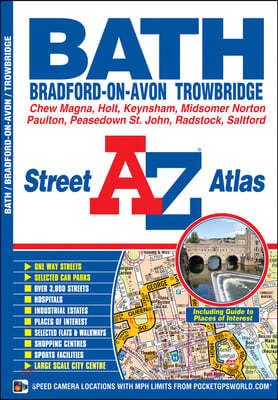
수입| Geographers | 2010년 10월9,070원 (18% 할인) 포인트적립 460원This street atlas of Bath, Bradford-on-Avon and Trowbridge has 42 pages of coloured street mapping and includes a guide to selected places of interest.
-
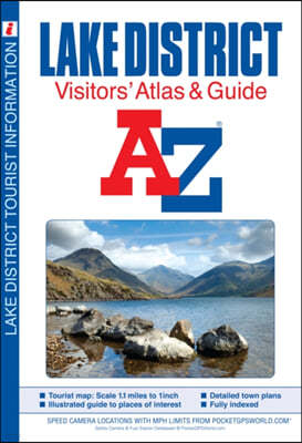
수입| Geographers | 2010년 05월10,910원 (18% 할인) 포인트적립 550원This full colour atlas and guide of the Lake District combines large scale road mapping (1.1 inches to 1 mile) with an illustrated town plan section to provide an informative tourist guide. Safety cameras with their maximum speed limit and fuel station locations are featured on both road and street ...
-
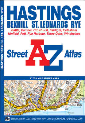
수입| Geographers | 2009년 05월9,070원 (18% 할인) 포인트적립 460원This atlas of Hastings, Bexhill, Battle, St. Leonards, Rye and Winchelsea has 38 pages of coloured street mapping that extends to:*Westfield, Doleham Station, Icklesham, Bowlers Town, Camber, Winchelsea Beach, Fairlight Cove, Cooden Beach, Russell's Green and Crowhurst.
-
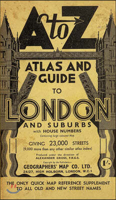
수입| Geographers | 2008년 12월18,250원 (18% 할인) 포인트적립 920원As a facsimile reproduction of the A to Z London Street Atlas, circa 1938/39, this publication shows street mapping of London as it was before the Second World War bombing and the redevelopments that followed and may be of assistance in tracing family history for that period.
-
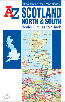
수입Geographers' A-Z Map Company / Geographers' A-Z Map Company(ILL) / Geographers' A-Z Map Company(EDT) | HarperCollins Publishers | 2008년 10월10,910원 (18% 할인) 포인트적립 550원This full colour double sided foldout road map of North and South Scotland is one of a series of five maps covering Great Britain, with a continuous grid referencing system which enables several or all of the sheets to be mounted together, whilst retaining the compatibility of the index.
-
수입| Geographers | 2008년 11월10,910원 (18% 할인) 포인트적립 550원This exciting and funny fable by well-loved children's author Allan Plenderleith, is sure to become a Christmas favourite with young and old.
-
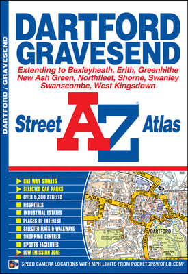
수입Geographers' A-Z Map Co Ltd | Geographers' A-Z Map Company Ltd. | 2008년 09월9,070원 (18% 할인) 포인트적립 460원This street atlas of Dartford, Gravesend, Bexleyheath, Erith, Northfleet, Sidcup and Swanley features 30 pages of coloured mapping that extends to:
-
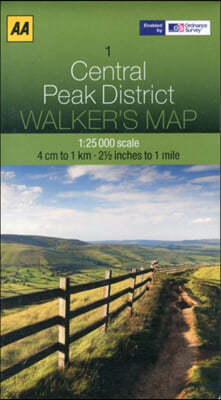
수입Automobile Association (Great Britain) | AA Publishing | 2012년 07월14,650원 (18% 할인) 포인트적립 740원Covering an area of 50km^2 and with a large scale of 1:25,000, this map has the familiar look and style of OS mapping, with improved coverage of the featured areas. Aimed at outdoor enthusiasts in particular, the level of details ensures nothing gets missed and you won't get lost.
-
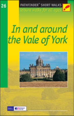
수입| Crimson Publishing | 2004년 04월10,980원 (18% 할인) 포인트적립 550원20 circular walks all graded by route and difficulty, they can be enjoyed by the whole family and are the ideal companion for day trips and holidays.
-
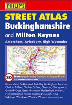
수입| Philip's | 2011년 03월12,820원 (18% 할인) 포인트적립 650원A fully revised edition of this pocket-sized, full-colour street atlas of Buckinghamshire, which gives complete, detailed coverage of the county. The atlas is suitable for both business and leisure use.
-
수입Collins Uk (COR) | Harpercollins Publishers | 2012년 10월8,240원 (18% 할인) 포인트적립 420원This easy-to-use, handy A5 sized road atlas is your ideal companion for travelling around Scotland. It has extremely clear, route planning maps of Scotland, detailed city plans of the major cities and towns and fits neatly into your glovebox or briefcase or bag. Scale of main maps: 1:625,0...
-
수입Collins Uk (COR) | Harper Collins Cartographic | 2012년 10월3,640원 (18% 할인) 포인트적립 190원Scale: 7.5 miles to 1inch. Handy little full colour map of Ireland. It is double-sided with the south of Ireland up to and including Dublin on one side and from Dublin northwards on the reverse. Ideal for the pocket, bag or glovebox of the car.
-
수입| Harper Collins Cartographic | 2012년 02월8,240원 (18% 할인) 포인트적립 420원A new edition of London's most original map. This hand-watercoloured map contains individual paintings of all the main sites and landmarks, shop-by-shop street maps, theatres and cinemas, comprehensive travel information and index. Street by street detailed map of Central London at a scale of 1:8,25...
-
수입| Harper Collins Cartographic | 2011년 09월21,990원 (18% 할인) 포인트적립 1,100원A4 format Scale 1:1 000 000 (1 cm to 10 kms / 1 inch to 16 miles) A fully revised edition of A4 spiral road atlas containing road mapping, route planning maps, larger scale road maps of the Ruhr and Rhine, city through route maps, city centre plans and a comprehensive place names index.
-
수입Collins Uk (COR) | Harper Collins Cartographic | 2011년 09월9,150원 (18% 할인) 포인트적립 460원Full colour double-sided map of Great Britain at 9 miles to 1 inch (1:550,000 approx.) with clear, detailed road network and administrative areas shown in colour.
-
수입Collins Uk (COR) | Harper Collins Cartographic | 2011년 09월10,990원 (18% 할인) 포인트적립 550원This handy A5 sized road atlas makes it the ideal travelling companion. It has extremely clear, route planning maps of Britain and Ireland and fits neatly into the glovebox, pocket or bag.
-
수입| Harper Collins Cartographic | 2011년 07월23,820원 (18% 할인) 포인트적립 1,200원This A4 format road atlas with popular lie-flat spiral binding features clear, detailed road mapping, at a scale of 3.2 miles to 1", with land height shown by attractive layer colouring. There are also a wide range of urban area approach maps at a larger scale as well as fully indexed street maps of...
-
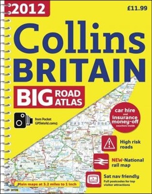
수입Collins Uk (COR) | Harper Collins Cartographic | 2011년 09월18,320원 (18% 할인) 포인트적립 920원The ultimate 3.2 miles to 1 inch scale large format road atlas for the year 2012, featuring Collins popular and well established road mapping; designed for exceptional clarity and ease of use. Includes a wide range of urban area maps at even larger scale plus 56 detailed town centre street plans. No...
-
수입| Harper Collins Cartographic | 2011년 07월21,990원 (18% 할인) 포인트적립 1,100원The ultimate 3.2 miles to 1" scale large format atlas for the year 2012, featuring Collins well established mapping; designed for exceptional clarity and ease of use. Includes a wide range of urban area maps at larger scale plus 56 town centre street plans. Now with speed limits shown at speed camer...
-
수입| Harper Collins Cartographic | 2011년 03월20,160원 (18% 할인) 포인트적립 1,010원Fully revised and updated reference atlas at a budget price in the exciting Collins world atlas range. This atlas provides more mapping area than any other atlas at this price. Specially designed presentation of maps in a clear, accessible format.


![Collins World Atlas [Essential Edition]](https://image.yes24.com/goods/6787355/L)

- 예스이십사(주)
-
대표 : 김석환, 최세라
주소 : 서울시 영등포구 은행로 11, 5층~6층(여의도동,일신빌딩)
사업자등록번호 : 229-81-37000 통신판매업신고 : 제 2005-02682호 사업자 정보확인
이메일 : yes24help@yes24.com 호스팅 서비스사업자 : 예스이십사(주)
Copyright ⓒ YES24 Corp. All Rights Reserved.

- 소비자피해보상보험 서울보증보험
- 고객님은 안전거래를 위해 현금 등으로 결제 시 저희 쇼핑몰에서 가입한 구매안전서비스를 이용하실 수 있습니다. 서비스가입사실 확인